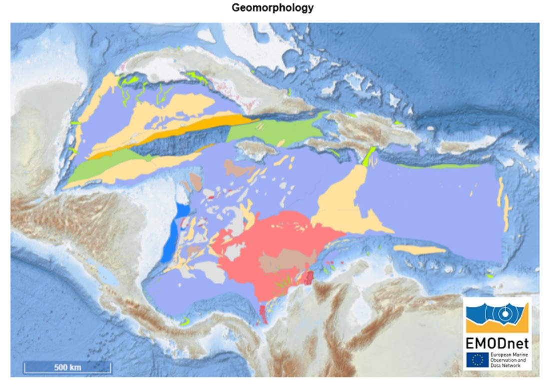
We are pleased to announce that the new cartographic products from the EMODnet Geology project are now available online for viewing and download. Among them, the Geomorphological Map of the Caribbean stands out, joining an extensive collection of newly released or updated spatial data layers.
During the project’s most recent phase, over 26 million km² of new or updated data were published, covering parameters such as: coastal resilience and vulnerability, coastal behaviour, seabed substrates, seafloor geology, marine geological events and associated probabilities, marine minerals, and submerged landscapes. Metadata for boreholes, samples, and geophysics have also been updated.
Representatives from ASGMI member institutions in the Caribbean region participating in the Marine Geology Expert Group — Geological Surveys of Colombia, Cuba, Costa Rica, Guatemala, Honduras, Mexico, and the Dominican Republic — contributed to the project under the coordination of the Geological and Mining Institute of Spain (IGME – CSIC), with datasets covering approximately 3.3 million km².
These maps and geological layers are essential tools for supporting territorial management, coastal planning, marine mineral assessment, geological hazard analysis, and strengthening resilience to climate change and coastal variability. The interface and data products have been optimized for ease of use, with revised attribute field names and improved accessibility.
We invite all ASGMI member institutions and the interested public to explore the new datasets through the EMODnet Geology portal.
Access the portal here: EMODnet Map Viewer.